So, driving back from the doctor (in Syracuse) I took a different route than the usual one and I saw this place which seems perfect for the Peach is a Whore project. So I dropped a pin on the location. Just click on the title of the post and when in Google Maps click on the pin and choose "street view" where you can actually see the place.
It looks great and it happens to be a student housing, I think for SUNY Cortland. It is about 20-30 min from IC. Further down the same road there are other "gothic" examples. I think one of them goes back to 1880 or so. Once in Google Maps at street level you can actually "drive" using your arrow keys until you find those other locations just North of the one I am linking to. How's that for virtual location scouting?
Showing posts with label google maps. Show all posts
Showing posts with label google maps. Show all posts
Monday, February 28, 2011


Tuesday, January 26, 2010
Another example of creative representation of information
Harry Beck showed a radically different approach in making map for London's railway network. He realized that geographically correct map was almost useless for travelers. So he created a topological map preserving "relative" position of different train stops rather than actual scaled distance. This was the paradigm shift in creating route maps and ever since Beck's revolutionary idea, almost all railway and bus route maps are made preserving topology rather than scale.


Map to scale:
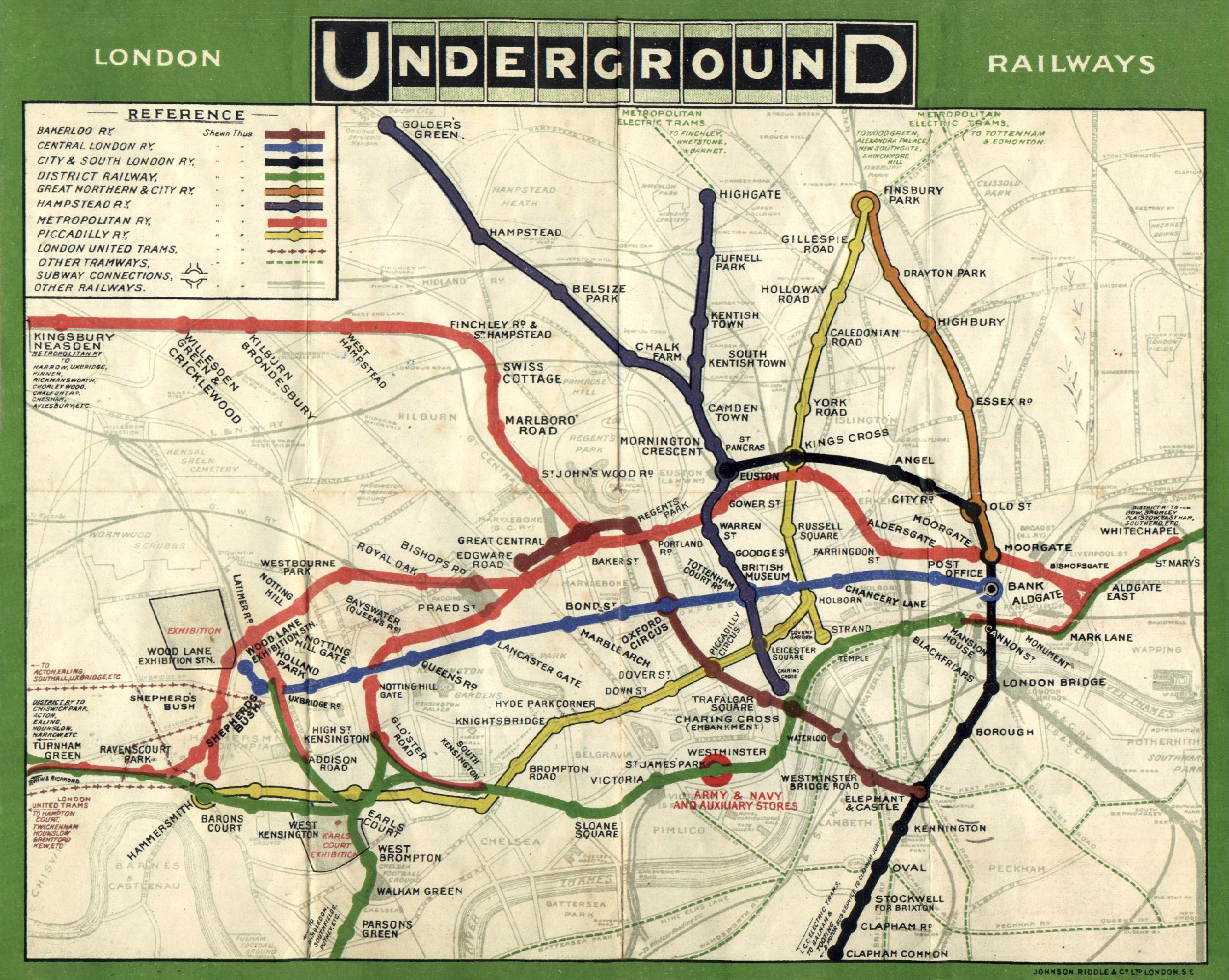
Beck's idea:

Tuesday, January 19, 2010
 Hi Everyone. First I would like to thank everyone for their warm wishes, their concerns and their help for the situation going on in Haiti. It's still unbelievable and I would love to have a time machine to go back to 1/12/10 16:52 right before the earthquake as in the movie flashforward. I am trying to hang in there as for the few seconds I was able to talk to my mom she made me promise not to drop out. I did and I will try to do my best.
My project might change as a result of what I am been living and the chaos that people are experiencing. Help is there but there haven't successfully reach people because there is a lack of communication due to language (for instance it was difficult to rescue three people because the Panamean team and the Israelian team couldn't communicate and it was impossible to find a translator speaking spanish and Hebrew.) The same situation prevails for food, water and medical assistance. As coordination appear to be the key, I was thinking of using a Promethean board linked to a GPS that will allow real-time visualization of the dispatch of helping troops and supplies (pretty much as what is offered by gpsrts.ufl.edu). I was thinking of having flags (representing the troops helping) logos of materials they are having in green, these that are about to finish in yellow and supplies that are lacking in red. Such a board would be at the airports thus teams know where to reach. Paths of streets will be colored the same way to attract attention on region that has yet received any help.
I hope this make sense. I have no clue how to do this right now. I will be thinking about it.
Thanks again for all your warm thoughts.
Subscribe to:
Posts (Atom)